7 March 2011 - Banded Precipitation Diagnostics

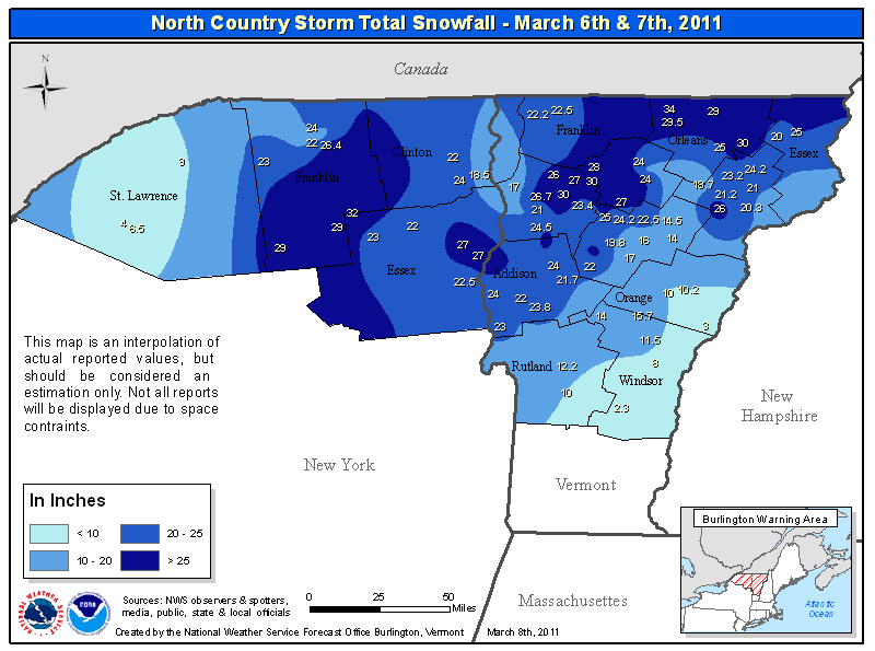
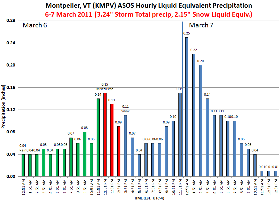
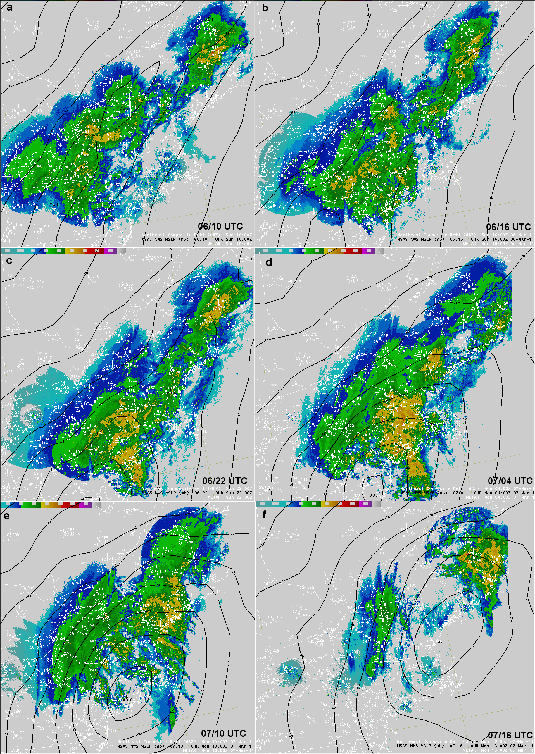
SUMMARY: Laterally quasi-stationary snowband (translation along long-axis of banded precipitation structures across NW VT and northern NY). Aspects of case generally consistent with other events, although Qs in this case may not be small.

Occurred during a positive phase of the NAO (5 Mar 2011 1.356;6 Mar 2011 0.969;7 Mar 2011 0.755;8 Mar 2011)

OVERVIEW IMAGES/LOOPS

6-7 March 2011 Snowfall Totals

Hourly precipitation rates at MPV

Hourly snowfall rates at BTV

BTV and MPV Meteograms

Mean 500mb Heights and Height Anomoly (6 March 2011)

Synoptic Composite 07/00z

6-hrly Composite Reflectivity and sea-level pressure

850mb moisture transport and PW


Upper-air maps: 7 March 2011 -- 00 UTC (top row) and 12 UTC (bottom row)
.925 mb.
.850 mb.
.700 mb.
.500 mb.
.300 mb.
.925 mb.
.850 mb.
.700 mb.
.500 mb.
.300 mb.
Mosaic Composite Reflectivity Loop (7 March 2011, 00-16 UTC)
NARR 925mb heights/winds/temperature (T-gradient color filled, 10-4 K/m)
NARR 850-700mb Layer Mean Temperature Advection
NARR 300mb heights/winds/temperature (isotachs color filled)
NARR Composite: 300mb Potential Vorticitiy/winds/divergence and 925mb heights/temperature

FRONTOGENESIS IMAGES

700mb Qn (07 UTC RUC, 0h FCST)
700mb Qs (07 UTC RUC, 0h FCST)
RUC 850-700mb Layer Mean Total Deformation and Streamlines (0-16 UTC, 0-h fcst)
RUC 850-700mb Layer Mean Frontogenesis and Streamlines (0-16 UTC, 0-h fcst)